ALTERNATIVE MAPS/TABLES
Six designated Alternatives will be subjected to an Environmental Assessment process to document and evaluate the environmental, cultural and economic impacts of each option. These Alternatives are derived from stakeholder and the public feedback over the past 15 years.
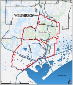
ALTERNATIVE 1
NO ACTION: Future without project: Continued area-wide flooding resulting in-
- Public safety concerns due to inability to evacuate affected families/individuals.
- Continued crop, livestock and equipment losses
- Wetland wildlife and aquatic habitat degradation
- Silt and sedimentation in waterways
- Increased soil salinity and decrease productivity
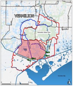
ALTERNATIVE 2
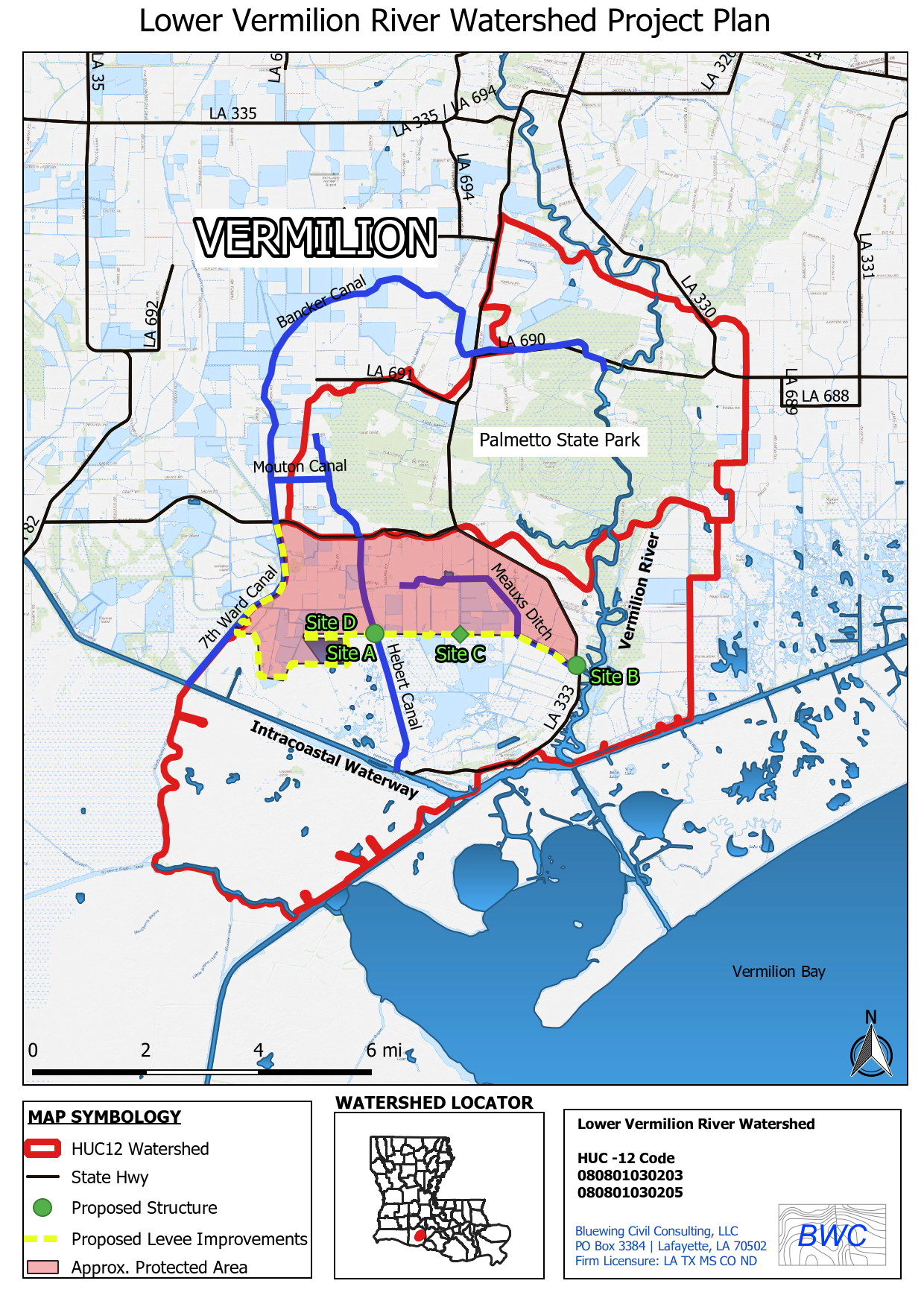
Approximate protected area: 12,610 acres
- Site A: Install control structure at Hebert Canal and LA 333
- Site B: Install control structure at Meaux’s Ditch and LA 333
- Site C: Install control structure in (unnamed) canal at LA 333
- Site D: Reinforced Levee along GIWW and LA 333
Alternative 2 Table
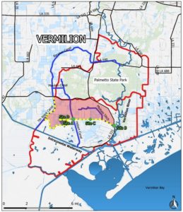
ALTERNATIVE 3
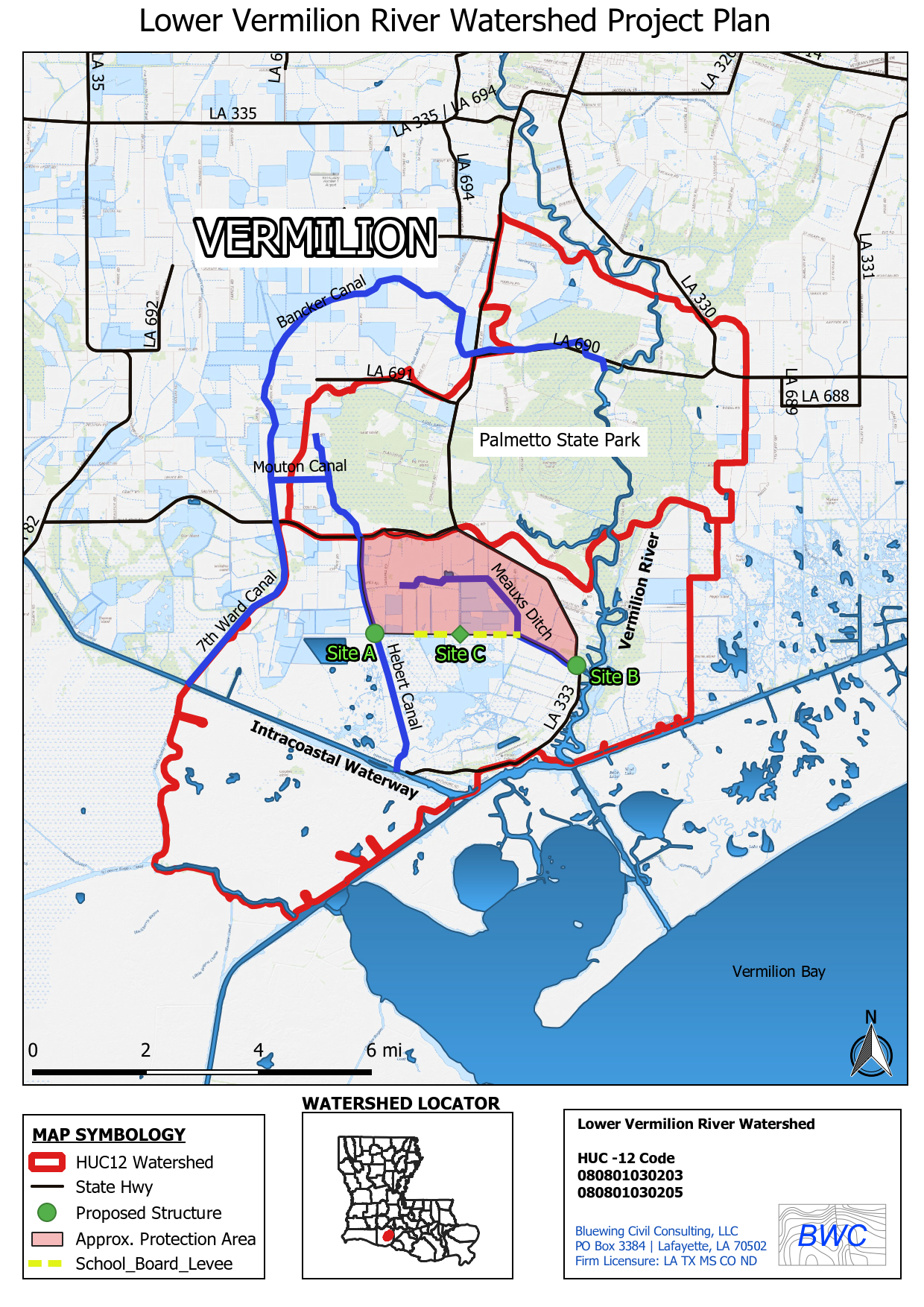
Approximate protected area: 6,255 acres
- Site A: Install control structure about a mile south of existing Hebert Canal structure
- Site B: Install control structure at Meaux’s Ditch and LA 333
- Site C: Reinforced School Board levee, install screw gate
- Site D: Reinforced 7th Ward Levee west of Hebert Canal
ALTERNATIVE 3 TABLE
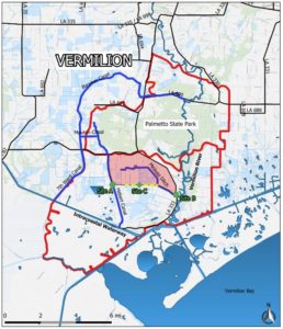
ALTERNATIVE 4
Approximate protected area: 3,588 acres
- Site A: Install control structure about a mile south of existing Hebert Canal structure
- Site B: Install control structure at Meaux’s Ditch structure and LA 333
- Site C: Reinforced School Board levee, install screw gate
ALTERNATIVE 4 TABLE
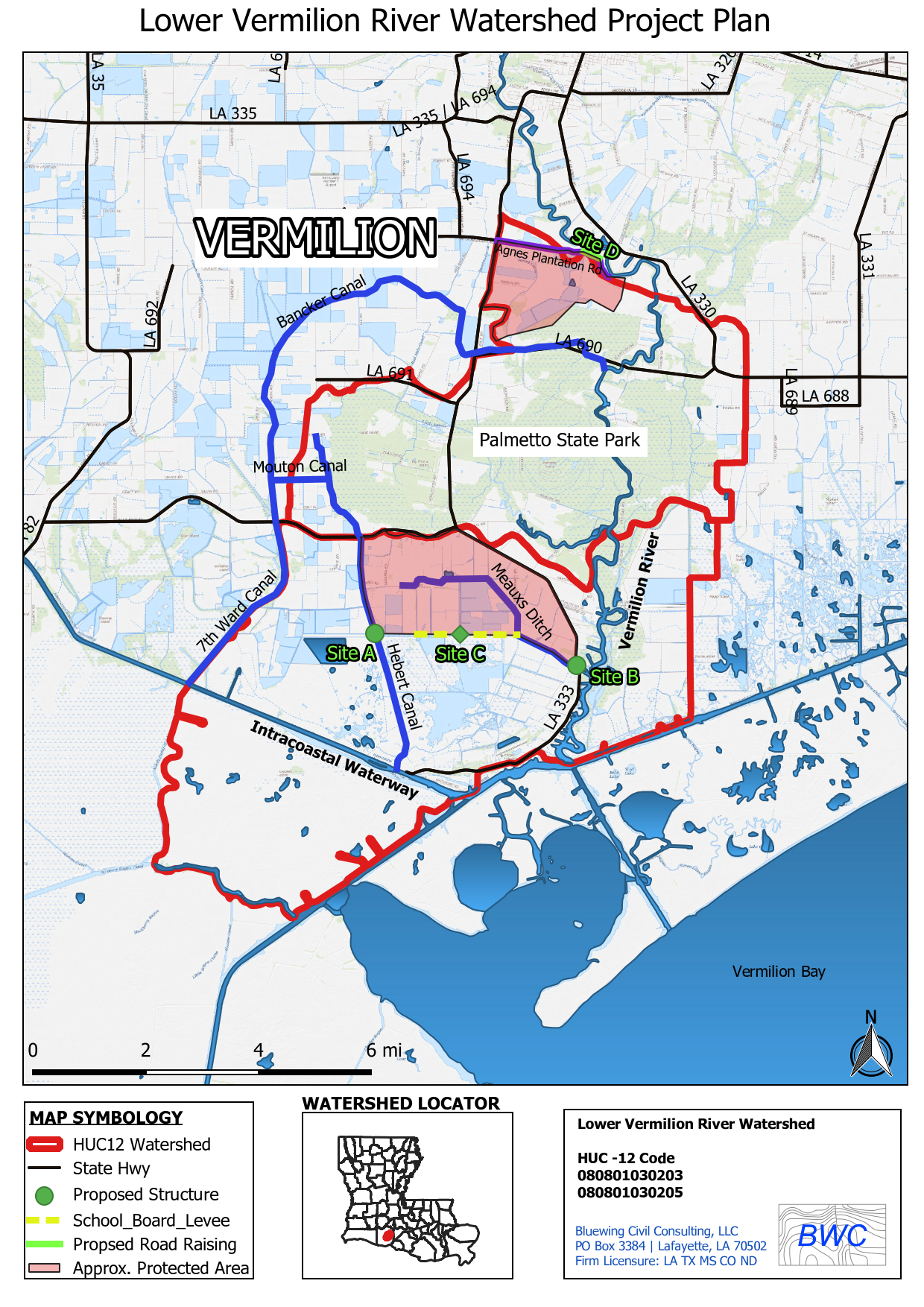
ALTERNATIVE 5
Approximate protected area: 5, 415 acres
- Site A: Install control structure about a mile south of existing Hebert Canal structure
- Site B: Install control structure at Meaux’s Ditch relocated to LA 333
- Site C: Reinforced School Board Levee, install screw gate
- Site D: Raise Agnes Plantation Rd near areas closest to Vermilion River
ALTERNATIVE 5 TABLE
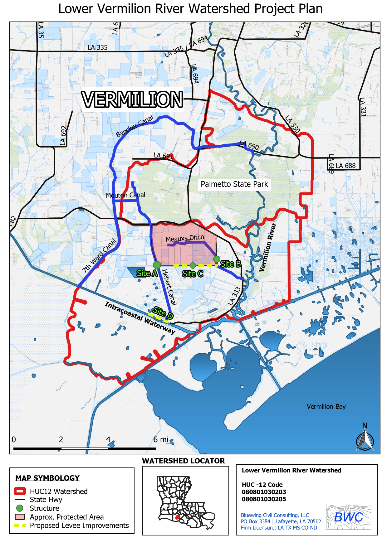
ALTERNATIVE 6
Initial preferred in the RFP
Approximate protected area: 2,780 acres
- Site A: Install control structure about a mile south of existing Hebert Canal structure
- Site B: Restore existing Meaux’s Ditch structure
- Site C: Reinforced School Board levee, install screw gate
- Site D: Levee enhancement along final 0.5 mile of Hwy 333 to Leland Boman Locks